
And once again, I have no photos from the DSLR for this post. I'll just have to share them at a later time. Think of it this way, you'll get to enjoy my trip even longer! Haha.
April 10: The day dawned early. We both roused awake with the sun around 6a. Within 10 minutes of waking, we'd stuffed the car back into some semblance of order and were out of the campground parking lot, headed back up the winding road to the park entrance toward the Mariposa Grove of giant sequoias. We stopped a few places along the way to wash our faces and take some photos while we were still in the valley.
 |
| Gooood morning. |
Once we were near the Wawona lodge, we pulled off to get some coffee at one of the gift shops. While I shopped around for postcards, magnets, and a map of the park, Mike chatted with the NPS volunteer at the shop (he makes friends EVERYWHERE). She informed us that seeing the trees was best done first thing in the morning as the parking gets full! Excellent. We were right on schedule to do that! Sadly though, she told us that the Glacier Point road was indeed closed until May1, as was the road to Tuolumne Meadows. Damn. That would limit my list of "to see" things. We'll just have to go back another year!
With hot coffee and tea in hand, we headed back to the car and wound our way up to the giant sequoias. As we passed the park entrance, we high-fived because the line of cars entering the park was endless! It was really fortunate that we'd come in the night before!
The parking lot for Mariposa held many giants, so we were humbled by their presence almost immediately when we pulled in. There is a loop road in the Mariposa grove that tour buses drive in the summer (after May 1), but for today, we'd have to walk 2.1 miles if we wanted to see all of the notable trees. No big deal.
We were around a lot of other visitors at the beginning of our hike. The most people were gathered about the notable trees, reading the plaques, taking photos, etc. As we continued on our uphill journey however, we saw fewer and fewer people.
The weather was absolutely perfect. Sun. Low to mid 70s. Low humidity.
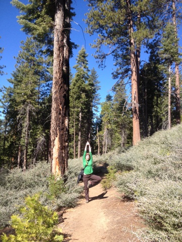
Mike and I really enjoyed the hike. We took our time, chatting as we went, stopping at each tree to get photos.


 |
| California Tunnel Tree |


 |
| Botanists, what are these? |


I remembered to turn on my Endomondo app to track our mileage after we'd hiked close to a mile per the signage on the trails. It would be good to know how far we'd hiked that day when we were done. I had tentatively plotted a second hike that day up Four Mile Trail (which was listed as 4.6 miles one-way, not four) so we could see the park vista from Glacier Point since the road was closed. If we knew what our average hiking speed was during our Mariposa hike, we'd be able to determine how feasible the second hike would be for that afternoon.
When we reached the top of the grove, we stopped at the fallen Tunnel tree. The tree fell in 1969 (I think). Its the one you see in a lot of photos where people drove their cars through it. There is the California Tunnel tree in a lower section of the park that has also had a tunnel cut through its trunk, but this opening isn't nearly as great as the opening in the original Tunnel tree had been. Fortunately, we're at a day and age where we respect these ancient giants more than we once did and we aren't maiming their precious tissues that carry food, water, and nutrients from the ground to the canopy.
Even fallen though, the Tunnel tree was impressive. Mike, of course, clambered up on the tree to pose absurdly for some photos before we turned tail and hiked back down the road to the parking lot.
Our hike downhill was faster than uphill, but not by much as we still stopped frequently to photograph trees as we went. Even the ones without plaques were impressive!
As we descended, we came across more and more people. It was pretty easy to tell that not many of these folks had, or would, hike to the top as we had. We were pretty thankful, once again, for our early start and our mid-week visit to the park. If these was what mid-week off-season looked like...I can't imagine a weekend during the summer. YUCK.
Back at the parking lot, Endomondo revealed that our hike had been more akin to 5 miles than the predicted 4.2 round trip that the signs estimated. And that was hiking the road for the second half that should have made it shorter! This wouldn't be our first experience with lying sign mileages in the park.
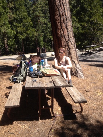
Once in the parking lot, we were really able to appreciate our early start. It was CRAWLING with people! People, buses, RVs, and cars, some circling the lot again and again in search of a parking spot. We'd briefly considered eating lunch in the parking lot, but with the scene that greeted our eyes, we high tailed it for the nearest picnic area instead, giving up our parking spot to someone with a greater need.
At the picnic spot just down the road, we pulled our our Whole Foods cache and leftover pizza to feast upon. It was a great little lunch.
During lunch we discussed our options for the afternoon hike. While I was certain we COULD do the 9+ mile hike to Glacier Point, I was concerned because I'd discovered a parenthetical notation on my new map that noted "(summer only)". It seemed that this trail, much like the Glacier Point road, was open seasonably due to the snow pack. Sigh. We decided that we would double-check the trailhead anyway, and if it were closed, we would go ahead and do another hike we'd planned to do the following day to see Vernal and Nevada falls.
On our way back to the valley floor, we stopped at the Tunnel View vista point. We'd stopped once on the way to the Mariposa grove, but with my new map in hand, I noted that both new and old Inspiration Point were a short hike above the Tunnel View point.
The parking lot for Tunnel View was PACKED. Ugh. Fortunately, Mike and I managed to snag a spot in the back, convenient because the trailhead was supposedly right there. We got out of the car with map and camera in hand, and went behind a series of bear-proof trashcans and scurried up some slab. There was no trail marked, but there was also no other option for where the trail could be. So we just went with it.
The slabby rock took us straight up above the tunnel, and ended up opening up right above the Tunnel View point parking lot. The vegetation made it hard for those in the parking lot to see the point where we were standing unless they really looked for it. It was really neat to gain the same view they had, but better, and without all the hustle and bustle of people. I loved the photos I was able to capture from this vantage point, and reveled in the fact that this was one of the points Aldo Leopold, John Muir, and Ansel Adams had enjoyed decades ago.
(Aside: While Mike and I were tourists, too, we have little tolerance for the kind of people most tourists are. We live in a very rural area that gets a lot of tourists here in WV, we work full and part-time within an industry that caters to tourists, and we have seen what most tourists will do to the land that we strive to preserve, that we love, and that we live in. The valley our ski resort is in is part of a very environmentally unique area that they have tried to turn into a national park a few times, and the locals have shown great disinterest in the idea because it will bring so many more people in who, while helping the local economy, will ultimately put the resource at jeopardy. Look at the big nat'l parks: Yosemite, Yellowstone,Grand Canyon, Great Smokies. These places walk a fine line as they strive to balance visitor resources with the natural resources that the park has been deigned to preserve. Mike and I hold a much higher level of respect for the land than the majority of people who visit natural resources like Yosemite. When we hike, we stay on designated trails the majority of the time to help protect areas of vegetation. We take much greater care with all of our actions because we know that they count. They help to preserve the amazing things nature has laid out that so many end up destroying in our quest to be the most first world. End rant. lol)


With some kickass photos in hand from our brief jaunt up to Inspiration Point, we continued winding our way down into the valley. A brief stop at the Four Mile trailhead revealed the the trail was, "Closed 2.8 miles ahead". Well hmmph. I'm sure the hiking would have been nice, but with no guarantee of a kickass view, I just didn't want to waste precious time (of which we had little) hiking that trail. So onward to Vernal and Nevada falls we went!
On the map, the trail appeared to be easy-going, along a flat grade with little incline. In reality? NOT. It was paved the majority of the way though. And it was crawling with people. And so we headed off. Eager and happy to be hiking along the Merced river that we could hear babbling the whole time.
Other than literally being uphill the whole way out and downhill back (oi my knees!), it was a really nice hike. After crossing the bridge over the Merced, the trail turned to dirt and then gained many, many stairs. But that was okay. The falls were right ahead and the mist from the water hitting the rocks below felt wonderful on our skin as we pranced up the stairs. Finally, after a sketchy ladder-step-ish stretch, we were at the top of Vernal Fall - the waterfall 3 people plunged off last summer to their deaths.
It was beautiful up there. Mike promptly shed his shirt and lay on the rock to be all lizard-like in the sun while I scampered down to the edge of the waterfall to take some photos. I fetched him when I was done, noting to him that he wouldn't be able to swim in the pool (wherein pool = geomorphological feature within the river, not a swimming pool) up there because that's why people died last year - swimming in the pool, flushing over the lip into the run and riffle and WHOOSH, over Vernal Fall.


 |
| The run/riffle/rapid area above the falls |
 |
| Emerald Pool |
We briefly considered hiking to the top of Nevada Fall, which we could see in the not-so-far distance, but I'd been keeping track of our hiking mileage based on what the signs predicted our mileage should be, and had already noted that GPS vs. sign was significantly different. What signs predicted to be another 0.9 (I think) miles to the top of Nevada was probably more like 1.5 miles at a minimum. Due to this, and our slowly hungering bellies, we opted to hike out.
...but not before Mike *waded* in the pool. Because wading is not swimming. -_- In all honesty, he really did only stand in the water on the extreme edge of a sheltered-away-from-other-people area up to his knees. He splashed the water onto the rest of his body to cool off, then got right out.
Our hike down was uneventful. Mike and I worked out a nice little support system when going down the stairs (steep and uneven; phenomenal trail building!) so that we could go faster by providing balance to each other. At one point when the stairs got a bit easier to navigate and weren't so steep/deep, I got into a kind of challenge with some 8 or 9 year old boy who felt he should repeatedly cut me off and try to beat me down the stairs. I wanted to tell him, "Dude, enjoy those short legs that keep you closer to the ground. This shit gets difficult when your legs are longer!" Buuutttt, I didn't.
With our hike complete, we headed to a campground with showers to get clean, and then mosied over to Yosemite Lodge for dinner. I had the trout and Mike had quail. Yum! Perfect portion sizes, too.
We stopped in another gift shop after dinner to get a few things for friends and snagged a few beers for the evening to enjoy before bed. We would spend this night in the car again, but back up towards the Wawona in a campground beside a river. This was much more peaceful and lent to better sleep for both of us.
: : : : :
April 11: With all possible hiking options to Glacier Point closed, we opted to just see a few remaining things within the valley that we hadn't seen yet before hitting the road back to Oakland and Funder's. Each stop was only for a few moments and only for the sake of seeing each thing and snagging photos.
First stop, Bridalveil Falls. It was at this primary stop when Mike and I quickly realizedwe weren't in Kansas anymore it was now the weekend (Friday). There were So Many People. We literally stood only long enough for me to snap a few photos before evacuating the area.

From Bridalveil we stopped at Cathedral Beach for a few serene moments. If it had been a month or two later in the summer we'd have taken time to swim. As it was, we could only admire the cool, clear water and add the location to our Must Return list.
After the beach, we stopped at "swinging bridge" which was really not so swinging and much more swaying. It offered a beautiful view of Yosemite Falls cascading down the cliffline with the Merced River in the foreground though. Not too many people were at this location, so Mike and I stood to enjoy it for a bit.


After the bridge, we made a jaunt by the little chapel in the valley for photographs. I'd picked up a post card with a stunning shot of the chapel with Half Dome in the background...yeah, must be an old photo because there were most definitely 30+ foot conifers in the way of that point of view!
From the chapel, we wound our way over the Merced and around to the Ahwanee - the fancy lodge in the park. I've visited lodges at several other national parks I've visited (this was my 12th park, to the best of my reckoning: Bryce, Zion, Grand Canyon, Teton, Yellowstone, Haleakala, Acadia, Denali, Yosemite, Joshua Tree, Great Smoky, New River Gorge), so seeing this one was something I had to do! It was very ritzy. Mike and I wandered the perimeter of the building so I could snag some shots. We were surprised (sort of) to see that the big "wood" beams of the building were actually concrete painted to look otherwise. So far, I can say without a doubt that the lodge at Yellowstone near Old Faithful is still the best lodge I've been to as far as its architecture!
Our penultimate activity in the park was to hike up to the base of El Cap. Mike and I are both climbers, so this big hunk of granite held more awe for us than man others. El Cap and Half Dome are featured in the bulk of climbing films out there. Nearly anyone who is anyone in the climbing world has climbed them at some point. Mike merely wanted to hike to the base and "touch it". So we did. And honestly? Looking up from the base of El Cap and studying the routes, it didn't look as scary as it looks in film. Sure, it looks difficult. I'm not poo-pooing that by any means. But the way El Cap and Half Dome appear on film - the sweeping, panning shots from helicopter and otherwise - isn't as representative of what it is in real life. I'd always imagined it as this huge unattainable goal for myself as a climber. I recognize that I'd really have to up my A-game to be able to tackle a feat of climbing endurance that is El Cap, but after seeing, feeling, and studying what I could from the valley floor, I no longer think such a feat for myself would be impossible! And that's a powerful thought. Now, do I *want* to climb it? Not particularly. Given that I reached a proper fitness level and had a strong partner (leader) and was offered the opportunity? I might. All the same, it was incredibly humbling to stand at the base of such a geologic feature - climbable or non.
Our final activity in the park before departing was a stop at the Merced for Mike to take a dip. Yes, it was nippy. Yes, he is crazy.


Our drive out of the park and back to Oakland was pretty uneventful. We made great time, even with our brief stop at a WalMart to return the sleeping bags. (I made Mike do it. I get awkward about things like that; his people skills are better.)
We arrived back at Funder's around 6:30p. She greeted us, showed us in, we all chatted briefly, and then she headed to fetch Graham from the BART after tasking us with juicing some key limes for margaritas. NOMZ.
While she was out (and after the key limes had been juiced), Mike and I took the time to quickly re-pack our stuff for our morning flight. We completed our task as Funder and Graham got home, just in time to settle into an evening of awesome conversation, alcohol, and one kickass dinner (Funder is the best chef).
With the best margarita I'd ever had in hand (OMG Graham is a wizard), Graham and Mike chatted about a myriad of things while I chatted with Funder about, what else, horses and endurance while she prepped an amazing dinner of dungeness crabs, noodles, bok choy, and eggplant. SO MUCH YUM! And yes, not surprisingly, Funder talked to the crabs just like Mike talked to the lobsters we cooked in Maryland a few weeks back. ;-)
Once dinner was complete, we sat around with a huge bowl of crab pieces and set to work, sipping drinks and chatting all the while. The crab was SO GOOD. And Funder was nice enough to make a simple garlic-butter sauce for me that wasn't spicy like the one she and Mike were using. <3 The whole meal was a complete mouthgasm. I was in lurv. Thank you, thank you, thank you, Funder and Graham!!!


After dinner, Mike and I spurred Funder to pull out their Cards Against Humanity which they hadn't even opened/played yet. Shame! We quickly had everything unwrapped and out on the table, rules (of which there are few) explained, and then we dove into action. It was one of the fastest games I'd ever played. Everyone around the table was a fast reader with wicked fast wit. We went through round after round so, so fast. It was hilarious. So much fun.
Finally, our full bellies kicked in and we all surrendered to sleep, but not before thanking Funder and Graham again for all of their incredibly hospitality. You two really made the trip for us!
First stop, Bridalveil Falls. It was at this primary stop when Mike and I quickly realized
From Bridalveil we stopped at Cathedral Beach for a few serene moments. If it had been a month or two later in the summer we'd have taken time to swim. As it was, we could only admire the cool, clear water and add the location to our Must Return list.
After the beach, we stopped at "swinging bridge" which was really not so swinging and much more swaying. It offered a beautiful view of Yosemite Falls cascading down the cliffline with the Merced River in the foreground though. Not too many people were at this location, so Mike and I stood to enjoy it for a bit.
After the bridge, we made a jaunt by the little chapel in the valley for photographs. I'd picked up a post card with a stunning shot of the chapel with Half Dome in the background...yeah, must be an old photo because there were most definitely 30+ foot conifers in the way of that point of view!
From the chapel, we wound our way over the Merced and around to the Ahwanee - the fancy lodge in the park. I've visited lodges at several other national parks I've visited (this was my 12th park, to the best of my reckoning: Bryce, Zion, Grand Canyon, Teton, Yellowstone, Haleakala, Acadia, Denali, Yosemite, Joshua Tree, Great Smoky, New River Gorge), so seeing this one was something I had to do! It was very ritzy. Mike and I wandered the perimeter of the building so I could snag some shots. We were surprised (sort of) to see that the big "wood" beams of the building were actually concrete painted to look otherwise. So far, I can say without a doubt that the lodge at Yellowstone near Old Faithful is still the best lodge I've been to as far as its architecture!
Our penultimate activity in the park was to hike up to the base of El Cap. Mike and I are both climbers, so this big hunk of granite held more awe for us than man others. El Cap and Half Dome are featured in the bulk of climbing films out there. Nearly anyone who is anyone in the climbing world has climbed them at some point. Mike merely wanted to hike to the base and "touch it". So we did. And honestly? Looking up from the base of El Cap and studying the routes, it didn't look as scary as it looks in film. Sure, it looks difficult. I'm not poo-pooing that by any means. But the way El Cap and Half Dome appear on film - the sweeping, panning shots from helicopter and otherwise - isn't as representative of what it is in real life. I'd always imagined it as this huge unattainable goal for myself as a climber. I recognize that I'd really have to up my A-game to be able to tackle a feat of climbing endurance that is El Cap, but after seeing, feeling, and studying what I could from the valley floor, I no longer think such a feat for myself would be impossible! And that's a powerful thought. Now, do I *want* to climb it? Not particularly. Given that I reached a proper fitness level and had a strong partner (leader) and was offered the opportunity? I might. All the same, it was incredibly humbling to stand at the base of such a geologic feature - climbable or non.
Our final activity in the park before departing was a stop at the Merced for Mike to take a dip. Yes, it was nippy. Yes, he is crazy.
Our drive out of the park and back to Oakland was pretty uneventful. We made great time, even with our brief stop at a WalMart to return the sleeping bags. (I made Mike do it. I get awkward about things like that; his people skills are better.)
We arrived back at Funder's around 6:30p. She greeted us, showed us in, we all chatted briefly, and then she headed to fetch Graham from the BART after tasking us with juicing some key limes for margaritas. NOMZ.
While she was out (and after the key limes had been juiced), Mike and I took the time to quickly re-pack our stuff for our morning flight. We completed our task as Funder and Graham got home, just in time to settle into an evening of awesome conversation, alcohol, and one kickass dinner (Funder is the best chef).
With the best margarita I'd ever had in hand (OMG Graham is a wizard), Graham and Mike chatted about a myriad of things while I chatted with Funder about, what else, horses and endurance while she prepped an amazing dinner of dungeness crabs, noodles, bok choy, and eggplant. SO MUCH YUM! And yes, not surprisingly, Funder talked to the crabs just like Mike talked to the lobsters we cooked in Maryland a few weeks back. ;-)
Once dinner was complete, we sat around with a huge bowl of crab pieces and set to work, sipping drinks and chatting all the while. The crab was SO GOOD. And Funder was nice enough to make a simple garlic-butter sauce for me that wasn't spicy like the one she and Mike were using. <3 The whole meal was a complete mouthgasm. I was in lurv. Thank you, thank you, thank you, Funder and Graham!!!
 |
| Banders and JibJab! |
 |
| An unamused JibJab lol |
After dinner, Mike and I spurred Funder to pull out their Cards Against Humanity which they hadn't even opened/played yet. Shame! We quickly had everything unwrapped and out on the table, rules (of which there are few) explained, and then we dove into action. It was one of the fastest games I'd ever played. Everyone around the table was a fast reader with wicked fast wit. We went through round after round so, so fast. It was hilarious. So much fun.
Finally, our full bellies kicked in and we all surrendered to sleep, but not before thanking Funder and Graham again for all of their incredibly hospitality. You two really made the trip for us!
: : : : :
April 12: Way too early up. Way too hungover. Damn you Mike and Funder for pushing the Boone's Farm on me! lol
Fighting nausea and dizzyness every step of the way, Mike and I got out the door and to the rental car place in record time. ...which was good because it was there that we ran into trouble.
The guy in charge of taking in the return car couldn't find our contract. So he passed us inside to a clerk there. Who was able to find the contract that I had signed that said we were to return the car to....San Diego. Returning it in Oakland would add $500 to our bill. NO.
Apparently dealing with the new guy + 3 other people + the computer crash + taking 90 minutes to get the damn rental in San Diego had still ended up in error to our car rental. We tried to be jovial and okay about the whole thing, rehashing the whole story to the clerk. She was baffled and really didn't know what to do though, especially after the San Diego office didn't pick up their phone, so she snagged the on-duty manager. We repeated our song and dance to this lady who, while being more assertive than the first woman, was still baffled. Mike decided to take matters into his own hands at this point and stepped away to call the San Diego office...who picked up. I was nauseous, tired, cranky, and just wanted to go home at this point. So I flopped my forehead onto the counter and pouted/cried a bit as Mike talked on the phone and the manager lady tapped away at her computer.
When the manager realized what Mike was doing, she snapped at me to have him get off the phone if I wanted her to fix the problem. She noted that it was disrespectful of him to handle it the way he was. I snapped, "MIKE!" At him and gestured for him to hang up. He did. Immediately. The manager was rather miffed with us at this point, I was upset because she was upset, and my hangover was being evil, and I wanted to go home, so I cried a little more.
Within a minute, she thrust a paper in our hands with the estimate we expected to pay, told us "sometimes you have to make an executive decision" and sent us away, obviously angry. Mike thanked her, I mumbled some nonsense. And we hustled out the door to the shuttle that would take us to the airport.
Once at the airport, I had a bit of a snag with security at first (repeatedly having to go through the screening), but fortunately it was early and not busy and the TSA agents were really friendly about the whole thing.
Finally, we were at our gate. Way too early it turned out, but sleep deprived Liz keeps poor track of time - at least I kept track poorly in the early and not late direction of time!
Our flights were all uneventful. The first leg offered free alcohol, and since Mike and I were in the last row, we ended up getting all the remaining beer from a big bottle of beer from a microbrewery in Oregon. I sipped mine half-heartedly, enough to appreciate the beer, but not enough to make myself drunk again. I still hadn't forgiven alcohol at this point. I kept pouring my remainder into Mike's cup which he was pretty okay with, haha.
It was midnight before we were back in DC, after 1am by the time we had completed our metro journey to where Saiph and Charles met us, and 6am before we were finally back at home.
I got to sleep until noon, when I bounded awake, bustled around the house unpacking and repacking for a week away for work, and then bounded out the door to see the horses for a short time before hitting the road by 3:30p for work.
The trip was incredible. Both Mike and I had an absolute blast. We did so much in a short amount of time that even now, weeks later, I'm still processing things! So much fun. We definitely have huge list of things to see/do on our Must Return list. Primarily more time to spend exploring both Big Sur and Yosemite.
Thank you again to Mandy, D, Funder, and Graham for making this trip so, so amazing. You all are THE BEST. <3
Fighting nausea and dizzyness every step of the way, Mike and I got out the door and to the rental car place in record time. ...which was good because it was there that we ran into trouble.
The guy in charge of taking in the return car couldn't find our contract. So he passed us inside to a clerk there. Who was able to find the contract that I had signed that said we were to return the car to....San Diego. Returning it in Oakland would add $500 to our bill. NO.
Apparently dealing with the new guy + 3 other people + the computer crash + taking 90 minutes to get the damn rental in San Diego had still ended up in error to our car rental. We tried to be jovial and okay about the whole thing, rehashing the whole story to the clerk. She was baffled and really didn't know what to do though, especially after the San Diego office didn't pick up their phone, so she snagged the on-duty manager. We repeated our song and dance to this lady who, while being more assertive than the first woman, was still baffled. Mike decided to take matters into his own hands at this point and stepped away to call the San Diego office...who picked up. I was nauseous, tired, cranky, and just wanted to go home at this point. So I flopped my forehead onto the counter and pouted/cried a bit as Mike talked on the phone and the manager lady tapped away at her computer.
When the manager realized what Mike was doing, she snapped at me to have him get off the phone if I wanted her to fix the problem. She noted that it was disrespectful of him to handle it the way he was. I snapped, "MIKE!" At him and gestured for him to hang up. He did. Immediately. The manager was rather miffed with us at this point, I was upset because she was upset, and my hangover was being evil, and I wanted to go home, so I cried a little more.
Within a minute, she thrust a paper in our hands with the estimate we expected to pay, told us "sometimes you have to make an executive decision" and sent us away, obviously angry. Mike thanked her, I mumbled some nonsense. And we hustled out the door to the shuttle that would take us to the airport.
Once at the airport, I had a bit of a snag with security at first (repeatedly having to go through the screening), but fortunately it was early and not busy and the TSA agents were really friendly about the whole thing.
Finally, we were at our gate. Way too early it turned out, but sleep deprived Liz keeps poor track of time - at least I kept track poorly in the early and not late direction of time!
Our flights were all uneventful. The first leg offered free alcohol, and since Mike and I were in the last row, we ended up getting all the remaining beer from a big bottle of beer from a microbrewery in Oregon. I sipped mine half-heartedly, enough to appreciate the beer, but not enough to make myself drunk again. I still hadn't forgiven alcohol at this point. I kept pouring my remainder into Mike's cup which he was pretty okay with, haha.
It was midnight before we were back in DC, after 1am by the time we had completed our metro journey to where Saiph and Charles met us, and 6am before we were finally back at home.
I got to sleep until noon, when I bounded awake, bustled around the house unpacking and repacking for a week away for work, and then bounded out the door to see the horses for a short time before hitting the road by 3:30p for work.
: : : : :
The trip was incredible. Both Mike and I had an absolute blast. We did so much in a short amount of time that even now, weeks later, I'm still processing things! So much fun. We definitely have huge list of things to see/do on our Must Return list. Primarily more time to spend exploring both Big Sur and Yosemite.
Thank you again to Mandy, D, Funder, and Graham for making this trip so, so amazing. You all are THE BEST. <3
No comments:
Post a Comment